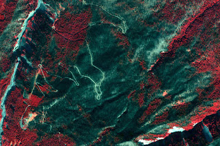
 We imaged the Gnarl Ridge Fire (NE slope of Mt. Hood in Oregon) last week with the high-resolution Quickbird sensor. I get so used to using Landsat and its 30m pixels that when I get something high res, I have to remind myself just how much more information we get...
But I'm not convinced high res is always better. There's so much information in this 3m imagery that it actually can become harder to use when I'm trying to find the mosaic of burn severity for the fire. Oh well. If the classified products don't work well, they can always just look at the imagery and see individual trees, dead or alive.

No comments:
Post a Comment